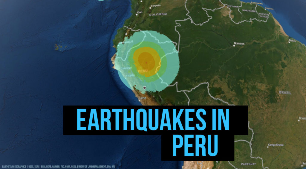
Peru is located in a seismic region. Every year there are a number of earthquakes whose intensity remains low. The population is prepared in case of earthquake and regularly in schools and workplaces, safety measures are taught and evacuation exercises carried out.
Earthquake history of Pery
1619 (February 14) – Trujillo – M 7.7
1664 (May 12) – Ica – M 7.3
1687 (20 October) – Lima – M 8.5
1746 (28 October) – Lima
1821 (July 10) – Camana – M 8.2
1868 (August 13) – Arica, Perou (Chile) – M 9.0
1908 (December 12) – Large of the central coast of Pero – M 8.2
1940 (24 May) – Callao – M 8.2
1942 (24 August) – Large of the central coast of Perou – M 8.2 –
1946 (10 November) – Ancash – M 7.3
1947 (November 1) – Satipo – M 7.3
1948 (May 11) – Moquegua – M 7.4
1950 (21 May) – Cusco – M 6.0
1953 (December 12) – Tumbes – M 7.4
1958 (15 January) – Arequipa – M 7.3
1960 (17 January) – Arequipa – M 7.5
1966 (17 October) – Near the Peruvian coast – M 8.1
1968 (June 19) – Moyobamba – M 6.9
1970 (May 31) – Chimbote – M 7.9
1974 (October 3) – Near peru’s central coast – M 8.1
1990 (May) – In the Alto Mayo region
1991 (April) – In the Alto Mayo region
2001 (June 23) – Near Peru’s Central Coast – M 8.4
2001 (July 7) – Near the central coast of Peru – M 7.6
2002 (October 12) – Peru-Brazil border – M 6.9
2005 (26 September) – Northern Peru – M 7.5
2006 (October 20) – Near Peru’s Central Coast – M 6.7
2007 (August 15) – August 15, 2007 earthquake in Peru – M 8.0
2007 (November 16) – Peru-Ecuador border – M 6.8
2011 (October 28) – Near Peru’s Central Coast – M 6.9
2014 (24 August) – 42 km east/northeast of Tambo, 469 km from Lima, at a depth of 58.9 km
2018 (14 January) – Northern Peru, M 7.3
2019 (26 May) -126 km from Peru, M 7.5