Share on facebook
Share on twitter
Share on telegram
Share on email

Snow and Ice Forecast

Snow and Ice Map

This map shows the forecast for snow and ice accumulation during the next 72 hours in the contiguous United States. It helps visitors see where winter storms may bring snowfall, freezing rain, and icy conditions. Snow and ice can make roads dangerous and may affect travel and daily activities. The map gives a clear overview of possible winter weather across the country.

Snow ice forecast map

Table of Contents

Forecast Data

The data for this map comes from the National Digital Forecast Database (NDFD). This database is created by the National Weather Service (NWS). It collects digital weather forecasts from many weather offices across the United States. These forecasts are prepared together with the National Centers for Environmental Prediction (NCEP), which are part of the National Oceanic and Atmospheric Administration (NOAA).

Hourly Updates

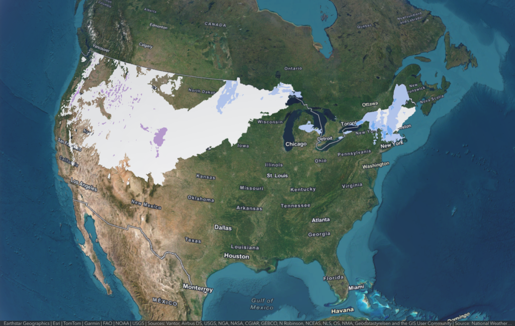
The map is updated every hour with new forecast information. This helps users see the most recent prediction for snow and ice. The forecast covers the next 72 hours, so people can follow how winter weather may develop during the next three days.

Interactive Map

This map is made for easy exploration and visualization. Users can click on any location on the map to see more details in a pop-up window. 

Information Notice

This map is provided for information only. The data comes from official weather forecast systems, but the service is not monitored all the time for accuracy. For safety decisions, people should always check official weather warnings and forecasts.